Brasstown, Longcreek
Relatively easy walk. Drive 2.6 miles down Brasstown Road. When the pavement ends continue 1.3 miles on the dirt road. Go right when the road forks. Go .4 miles to the parking area and see the trailhead


Relatively easy walk. Drive 2.6 miles down Brasstown Road. When the pavement ends continue 1.3 miles on the dirt road. Go right when the road forks. Go .4 miles to the parking area and see the trailhead
Bull Sluice is a Class 5 rapid on Section III of the Chattooga River. It's a short .2 mile hike from the Hwy 76 Chattooga River Access parking lot. Follow the trail downhill to where it forks, go right to viewing area.


Moderate 1/4 mile hike. Great picnic spot and swimming along the river. From Walhalla, take Hwy 28 North 7 miles. Turn left on Whetstone Road (S193), go 3 miles to Blackwell Bridge over Chauga River.
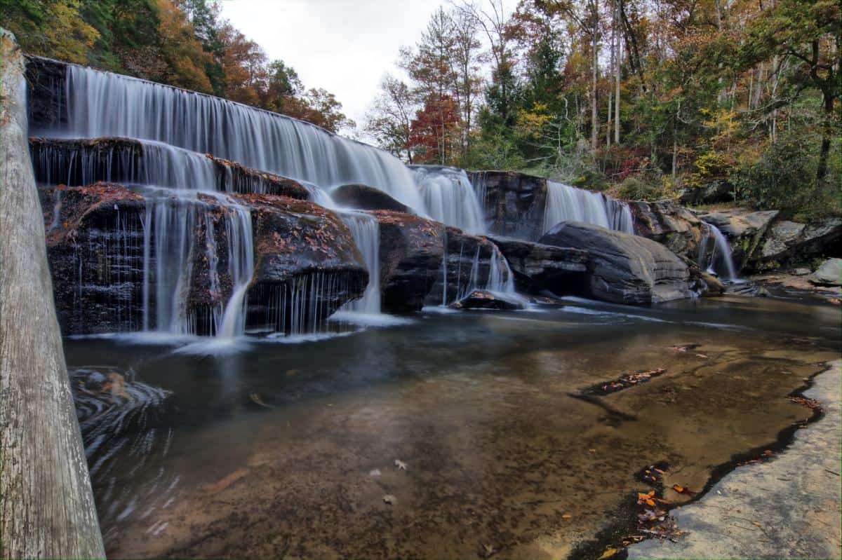
Some waterfalls are handicap accessible and located near parking areas. From Westminster: Drive west on US 76. Keep right at the fork with US 123 and drive another 2.5 miles. Turn left onto Chau Ram Park Road.


Easy 5-minute walk to viewing platforms. Located in Stumphouse Park off Hwy 28. Trail next to the lowest platform leads to the base of the falls IS QUITE DANGEROUS, visitors are not encouraged to attempt.
Located on Lake Jocassee, this waterfall is only accessible by boat. Launch from Devils Fork State Park. For exact location of the falls, stop by the Devils Fork Ranger Station for map and detailed directions.


Easy 1-hour hike. From Walhalla, Hwy 28 North to SC 107. Take 107 for 3.1 miles, turn left at Village Creek Rd, Drive 1.7 miles, turn right onto Nicholson Ford Road (FS 775). Drive 2.2 miles to a parking area. Hike west on the Foothills Trail (NW corner of the lot) for .5 mile. Turn left onto the Chattooga Trail. Hike .2 mile to Pigpen Falls. Cross the footbridge for .2 mile on the Chattooga Trail and the first level of Licklog Falls will be to the right of the trail. The 2nd level is approximately 50 yards downstream.
Moderate hike. From Westminster, drive west on US 76 for 7.5 miles to the 2nd right onto Cobbs Bridge Road. Drive 1.6 miles and turn left onto Spy Rock Road (FS 748, which is gravel). Drive 1.8 miles to FS 748-C (on the right) and park by the side of the road. Hike (east) on FS 748-C for 0.3 miles to the trail and hike .7 miles to the falls.

Moderate 3 mile hike round trip. Impressive 60 ft. cascade over rock ledges is a favorite destination for visitors. No cell service in the forest. From Walhalla, drive west 6.8 miles on SC Highway 28, and turn left into Yellow Branch Picnic Area.
The Museum of the Cherokee in Mountain Rest, South Carolina, stands as a testament to the rich cultural heritage of the Cherokee people.
